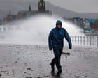
High winds are tearing across the northern half of the UK right now, and the Met Office has slapped weather warnings across Scotland, Northern Ireland, and northern England as Storm Boelo moves in. If you live anywhere north of Manchester, your commute, your power supply, and your weekend plans are directly in the firing line.
Most weather reports just copy-paste the official forecast and leave you guessing what a yellow wind warning actually means for your front door. Let's cut through the noise. Storm Boelo isn't just another blustery afternoon; it's a low-pressure system packing the kind of gusts that rip roof tiles off older terraced houses and turn high-sided lorries into hazards on exposed motorways. In similar updates, we also covered: Stop Complaining About Back-to-Back Storms Because Bad Weather Is the Best Thing Happening to Your Local Economy.
Where Storm Boelo Is Hitting Hardest
The Met Office alerts cover a massive swath of territory, stretching from the northern coast of Scotland down through the Central Belt, across the Irish Sea into Northern Ireland, and sweeping over Cumbria, Northumberland, and parts of Yorkshire.
Coastal areas and high ground are taking the brunt of it. In places like the Outer Hebrides, the Antrim coast, and the Pennines, wind speeds regularly outpace inland valleys because there's nothing to slow the air down as it comes off the Atlantic. When a named storm tracks this far north, the tight pressure gradients create a funnel effect through the Irish Sea and the North Channel. The New York Times has also covered this important issue in extensive detail.
Here is how the regional impact breaks down right now:
- Scotland: The Highlands, Islands, and western coastal communities face the highest peak gusts, with ferry routes across the Clyde and Hebrides almost always the first casualties of a system like this.
- Northern Ireland: Exposed eastern and northern coasts are seeing severe gales, putting coastal roads and cross-channel ferry crossings from Belfast and Larne at high risk of cancellation.
- North of England: The Lake District, North Pennines, and the Northumberland coast are dealing with crosswinds that make driving on the A66, M6 over Shap, and the A1 particularly treacherous.
Why Named Storms Cause So Much Chaos in the UK
You might wonder why a storm with winds in the 60 to 70 mph range causes headlines in Britain when hurricanes in the Atlantic hit twice that speed. Context matters.
Our infrastructure isn't built like Florida's. Millions of homes across Scotland and northern England rely on overhead power lines that run right alongside mature, shallow-rooted trees. When heavy rain saturates the soil before or during a wind event, the ground turns to soup. Trees don't snap; they uproot entirely, dragging power cables and telephone poles down with them.
Timing also plays a huge role. Storm Boelo is battering the region during active travel windows, meaning bridges like the Forth Road Bridge, Queensferry Crossing, Humber Bridge, and the Tyne crossings face strict speed restrictions or outright closures for high-sided vehicles. One overturned lorry on the M62 or A74(M) doesn't just block a road—it gridlocks an entire region for eight hours.
How the Met Office Decides to Name a Storm
People love to complain that the Met Office names storms too easily these days. Honestly, that criticism misses the point. The UK storm-naming system—run jointly with Met Éireann in Ireland and KNMI in the Netherlands—isn't based purely on wind speed. It's based on impact.
A 65 mph gust on a Sunday morning in July causes minor annoyance. That exact same 65 mph gust on a weekday during peak commuter hours, combined with wet ground and leaf-covered drains, triggers widespread transport failure and localized flooding. Naming the system gives emergency services, local councils, and regular people a single, clear label to track instead of vague talk about "an area of low pressure."
What Most People Get Wrong About Yellow Wind Warnings
See a yellow warning on your phone and your first instinct is probably to ignore it. Amber and red warnings get the panic-buying; yellow warnings get a shrug. That's a mistake.
A yellow warning doesn't mean the weather will be mild. It means the forecast has a high likelihood of causing low-level disruption, or a lower likelihood of causing severe, localized damage. During Storm Boelo, the difference between a breezy morning and a tree crashing through your conservatory comes down to micro-geography. If you live at the bottom of a hill where wind funnels between two ridges, you'll experience conditions far worse than the regional average reported on the evening news.
Another common blunder is assuming the danger ends the second the wind drops. It doesn't. Damaged tree limbs—arborists call them "widow-makers"—often stay wedged high in the canopy until a lighter breeze knocks them loose days later. Loose ridge tiles shift during the peak of the storm and slide off the roof the next morning when you're walking out to your car.
Travel Disruptions You Should Expect Right Now
If you're planning to travel across Scotland, Northern Ireland, or northern England while Storm Boelo is active, expect delays. Train operators like ScotRail, TransPennine Express, LNER, and Northern routinely impose blanket speed restrictions—often dropping trains from 100 mph down to 40 or 50 mph—whenever high winds hit.
Why? Because debris on the tracks at high speed derails trains, and extreme crosswinds can blow overhead electric lines right off a train's pantograph. When a single train gets stuck behind a fallen tree on a main line like the West Coast Main Line or the East Coast Main Line, the timetable collapses across the entire country.
Air travel isn't immune either. Airports with exposed runways like Belfast International, Glasgow, Edinburgh, and Newcastle frequently see crosswind landings push pilots to their limits. Go-arounds and diversions are standard procedure when gusts exceed aircraft crosswind thresholds, so check your flight status before leaving the house rather than waiting until you're sitting in the terminal.
Practical Steps to Protect Your Property and Yourself
You can't stop Storm Boelo, and you can't reinforce your roof in the middle of a gale. You can stop small problems from turning into expensive insurance claims.
- Clear the garden immediately. Trampolines are the undisputed champions of storm damage in the UK. If yours isn't bolted into the ground with heavy-duty anchor kits, flip it upside down or dismantle the net. Bring in wheelie bins, garden furniture, and loose plant pots—anything light enough to lift can shatter a patio door or dent a neighbor's car.
- Charge everything before the lights flicker. Power cuts during windstorms happen without warning when branches hit transformers. Top up your phone, grab any portable power banks you own, and locate a proper torch so you aren't burning through your phone battery using the screen as a light.
- Park away from big trees and old walls. If you have a driveway next to a mature oak or a weathered stone boundary wall, move your car onto the street or a more open spot until the warning expires. Comprehensive car insurance usually covers storm damage, sure, but losing your vehicle for six weeks while a body shop waits on parts is a nightmare you don't need.
- Stay off coastal promenades. Every single storm brings out people trying to film massive waves crashing over sea walls for social media. It's reckless. Sea spray carries rocks and shingle at lethal speeds, and a single rogue wave can sweep an adult off a harbor wall in half a second.
- Check on elderly neighbors. High winds combined with dropping temperatures make power outages genuinely dangerous for older residents. Knock on their door before the worst of the weather hits to make sure they have working lights, a charged phone, and a way to stay warm if the boiler loses power.
What to Do If the Power Goes Out
If Storm Boelo knocks out your electricity, don't assume your neighbors have already reported it. Call 105 immediately—it's the free national power cut helpline across England, Scotland, and Wales (in Northern Ireland, contact NIE Networks directly). Distribution network operators use those calls to pinpoint which specific circuit breaker tripped or where a line came down.
Keep your fridge and freezer doors shut. A full freezer will safely hold its temperature for up to 48 hours if you stop opening it to check on your food. Unplug sensitive electronics like desktop computers and TVs too; when engineers restore power after a storm fault, voltage surges can fry circuit boards instantly. Leave a single lamp switched on so you know the exact moment the grid comes back online, then wait ten minutes before plugging your expensive gear back in.