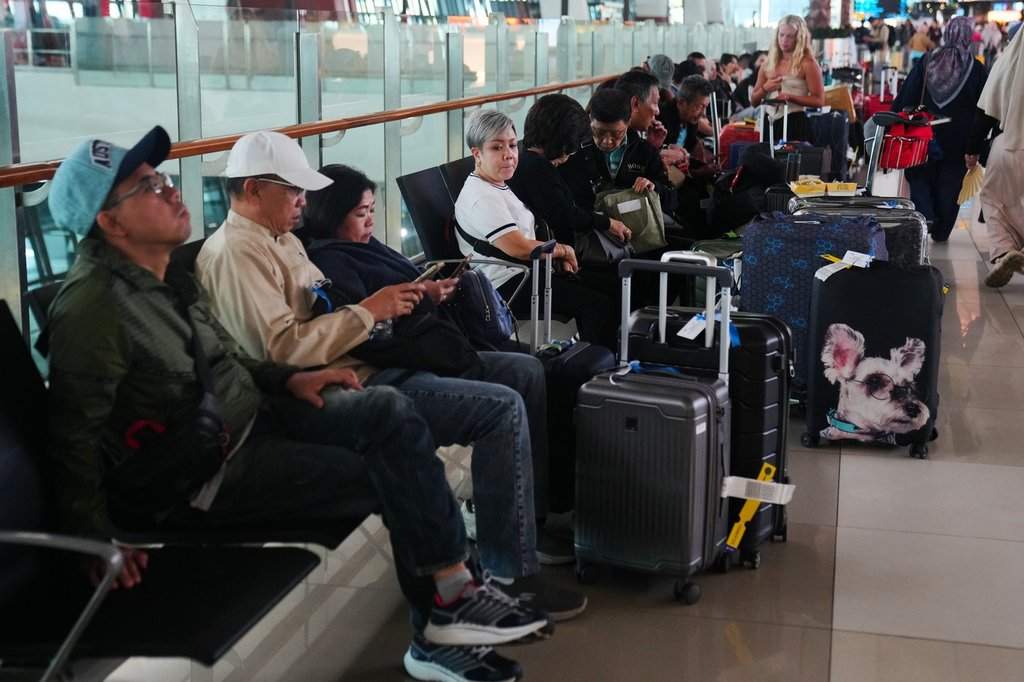
Anak Krakatau has erupted again. Thousands of travelers stand stranded across the Sunda Strait as ash plumes choke regional airspace and flight cancellations cascade through Indonesian transit hubs.
The immediate headlines focus on the logistical paralysis, grounded aircraft, and frustrated passengers waiting in terminal lobbies. That perspective misses the greater danger. Anak Krakatau is not merely a tourist disruption or a temporary aviation hazard. It is a live-fire geologic stress test for an entire archipelago.
The Anatomy of a Sunda Strait Collapse
To understand why a single eruption of Anak Krakatau causes systemic chaos across Indonesia, you have to look backward. In August 1883, the original Krakatau volcano exploded in one of the most violent cataclysms in recorded human history. That blast collapsed the volcanic edifice, generating monstrous tsunamis that killed over thirty-six thousand people. Anak Krakatau, meaning Child of Krakatau, emerged from the submerged caldera of its parent in 1927. It has been growing ever since, stacking loose volcanic debris on an unstable underwater slope.
Growth on a steep submarine slope creates an inherent structural vulnerability. The volcano continuously builds outward and upward faster than its materials can cement together. When magma pushes upward, it destabilizes the flanks.
In December 2018, that exact mechanism triggered catastrophe. A massive portion of Anak Krakatau's southwestern flank slid into the sea. The underwater landslide displaced millions of cubic meters of water instantly, generating a deadly tsunami that struck the coasts of Java and Sumatra without warning. Sirens did not sound because traditional sensor buoys cannot detect underwater mass movements close to shore.
When Anak Krakatau erupts today, aviation authorities and disaster management agencies do not simply worry about ash clogging jet engines. They worry about repetition. Every major eruption cycle brings the latent threat of another flank collapse.
Aviation Vulnerabilities and Airspace Management
Modern commercial aircraft engines and volcanic ash mix like sugar and machinery. Jet fuel burns at temperatures high enough to melt silicate minerals found in volcanic ash. Once melted, these minerals ingest into the turbine blades, cool rapidly, and solidify into a glass-like coating. This chokes airflow, stalls the compressor stages, and causes catastrophic engine flameouts.
Air traffic controllers across Southeast Asia face an impossible balancing act when Anak Krakatau blows. Wind patterns shift rapidly over the Sunda Strait, pushing fine abrasive dust toward Jakarta's primary international gateways and regional domestic strips.
- Ash dispersion modeling relies on satellite observations and ground-based radar feeds that often lag behind real-time atmospheric shifts.
- Carrier liability forces individual airlines to make conservative cancellation calls, stranding thousands before regulatory bodies officially close airspace sectors.
- Infrastructure bottlenecks leave regional airports unequipped to handle tens of thousands of grounded passengers simultaneously.
Passengers stranded in Jakarta or regional hubs experience the downstream effects of this defensive posture. Airlines cancel flights preemptively because the financial and human cost of flying an aircraft into an unmapped ash cloud is unthinkable. Yet, this caution paralyzes economic corridors that rely on the Sunda Strait as a primary maritime and air transit bridge between Java and Sumatra.
The Warning System Gap
Indonesia sits directly on the Pacific Ring of Fire. The nation maintains one of the most sophisticated volcanological agencies on earth, monitoring dozens of active peaks with seismic networks, tiltmeters, and visual surveillance.
Despite this infrastructure, monitoring a restless island volcano like Anak Krakatau remains deeply problematic. The volcano sits in the middle of a marine strait, exposing delicate monitoring equipment to corrosive saltwater, violent storms, and destructive wave action. Instruments fail frequently. Replacing them requires hazardous maritime expeditions that cannot launch during active eruptive phases.
Furthermore, subaerial monitoring does not capture underwater shifts. Volcanologists can measure seismic tremors and surface gas emissions with precision, but detecting whether the western flank of a cone is silently creeping toward a marine collapse requires sonar arrays and tilt sensors mounted on the ocean floor. Coverage remains sparse.
When thousands of travelers find themselves stranded due to sudden flight suspensions, it is the visible symptom of an invisible information gap. Authorities often pull the trigger on airspace closures based on surface explosions and satellite ash plumes, operating with limited visibility regarding the structural integrity of the volcanic cone itself.
Living on the Edge of the Caldera
Millions of people live within the shadow zone of the Sunda Strait. Coastal communities on both sides of the water have built livelihoods around fishing, trade, and tourism, treating the rumbling horizon as background noise until the ash starts falling.
Mitigation strategies have evolved since the 2018 disaster, but human behavior remains difficult to engineer. Evacuation routes are mapped, yet population growth along vulnerable coastal strips continues unchecked. Tourism infrastructure expands on beaches directly exposed to potential localized tsunamis.
The thousands stranded at airports represent the temporary friction of modern mobility interrupted by nature. The real vulnerability lies permanently anchored along the shores of the Sunda Strait, waiting for the next shift beneath the waves.


