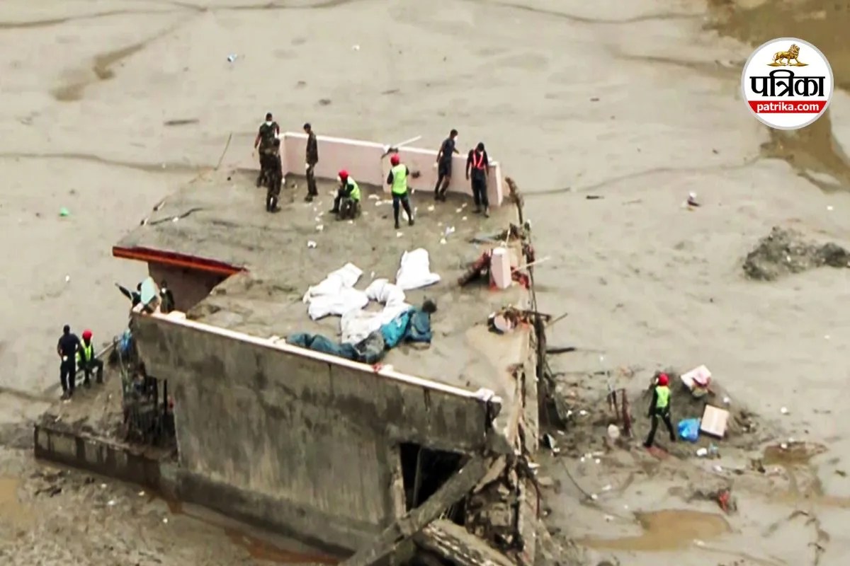
On August 26, 2026, a massive section of the Langtang Lirung glacier in Nepal fractured, initiating a chain reaction that sent a debris avalanche hurtling down 1,200 vertical meters into the Lende Khola valley. The resulting flash flood surged through the Trishuli River basin, obliterating infrastructure and trapping thousands in a matter of minutes. Initial reports misattributed the shockwave to a tectonic earthquake because the ice and rock impact registered as a magnitude 5.2 seismic event. This analytical failure at the onset highlights a systemic vulnerability in how transboundary river basins monitor high-altitude cryospheric hazards.
Evaluating disaster response infrastructure requires dissecting the mechanics of the event through three functional components: the kinetic trigger, the hydraulic amplification loop, and the warning latency gap. Each variable operates on a compressed timeframe that renders traditional disaster management frameworks obsolete.
The Kinetic Trigger and Energy Conversion
The disaster originated from the structural failure of bedrock and ice at an elevation of approximately 5,200 meters. Satellite imagery confirms that a roughly 0.2 square kilometer ice mass detached from the peak, dropping sharply into a confined gorge.
The physical mechanics of this descent involve an extreme conversion of potential energy into kinetic energy. As millions of metric tons of ice, rock, and compressed snow impacted the valley floor, the frictional heat generated by the descent instantly liquefied a significant fraction of the fractured ice. This transformation bypassed the gradual melting curve typical of seasonal warming.
The resulting slurry of mud, boulders, and water acted as a high-density fluid mass. Unlike standard water floods, this debris flow maintained an exceptionally high specific gravity, allowing it to entrain additional sediment and strip riverbanks bare as it traveled downstream at speeds approaching 150 kilometers per hour. The energy profile mirrors a high-yield explosion, explaining why global seismometers picked up the impact signature as a tectonic event rather than a surface mass movement.
The Hydraulic Amplification Loop
Once the debris avalanche entered the narrow high-mountain gorges of the Lende Khola, a hydraulic amplification loop took effect. The initial surge constricted within the steep valley walls, causing water and sediment levels to spike by at least 70 meters above normal baselines in the upper gorges.
As the torrent hit the broader channels of the Trishuli River, the wave compressed downstream, raising water levels by 9 meters within a frantic 30-minute window. This dynamic created a series of temporary barrier lakes behind makeshift debris dams. These natural impoundments introduced a secondary hazard vector: sudden dam-break floods that occurred hours or days after the initial impact, complicating recovery efforts and threatening rescue teams.
Critical infrastructure, including the Gyirong border port and multiple run-of-the-river hydroelectric facilities, sat directly within this high-velocity hydraulic corridor. Traditional engineering standards for these installations account for standard monsoon peaks and predictable river discharge volumes. They fail completely when confronted with a high-density, multi-million-cubic-meter debris wave that alters the physical topography of the riverbed in real-time.
The Warning Latency Gap
Mitigating loss of life in high-altitude drainage basins depends entirely on minimizing the time delta between anomaly detection and public evacuation. In the case of the Langtang collapse, this latency gap was fatal.
Traditional early warning systems rely on river gauge sensors downstream that measure volumetric increases in water flow. When a flood is driven by intense rainfall, these sensors provide a valuable window of hours. However, a cryospheric collapse generates an immediate, localized shockwave at the source with zero meteorological precursors. There was no heavy rainfall recorded at the district headquarters that morning, eliminating rain-based predictive alerts.
By the time the surge registered on downstream gauges, the transit time to populated settlements like Devighat and border trading posts was measured in minutes. Evacuation protocols designed around manual relay of information or slow bureaucratic verification loops cannot function under a sub-hour timeline.
Systemic Vulnerability Factors
The human and economic toll of the disaster stems from structural mismatches between regional development patterns and cryospheric risk profiles. Economic corridors in the Himalayas frequently occupy narrow river terraces because flat terrain is scarce. This geography concentrates trade routes, highways, and tourist infrastructure precisely where high-energy debris flows naturally channel.
Furthermore, transboundary river management between regional stakeholders historically suffers from fractured data sharing. Because the glacial source zones often sit in high-elevation borderlands—such as the Tibetan autonomous zones feeding into Nepal—real-time telemetry requires cross-border synchronization that is rarely operationalized during sudden-onset events.
To prevent future mass casualties from similar high-altitude failures, regional strategy must shift from reactive post-disaster recovery to automated, acoustic-and-seismic sensor arrays installed directly beneath unstable glaciers. These networks must bypass human authorization layers to trigger automated audio-visual sirens in downstream valleys the millisecond a high-altitude mass movement occurs, shrinking the warning latency gap to match the speed of the catastrophe.


