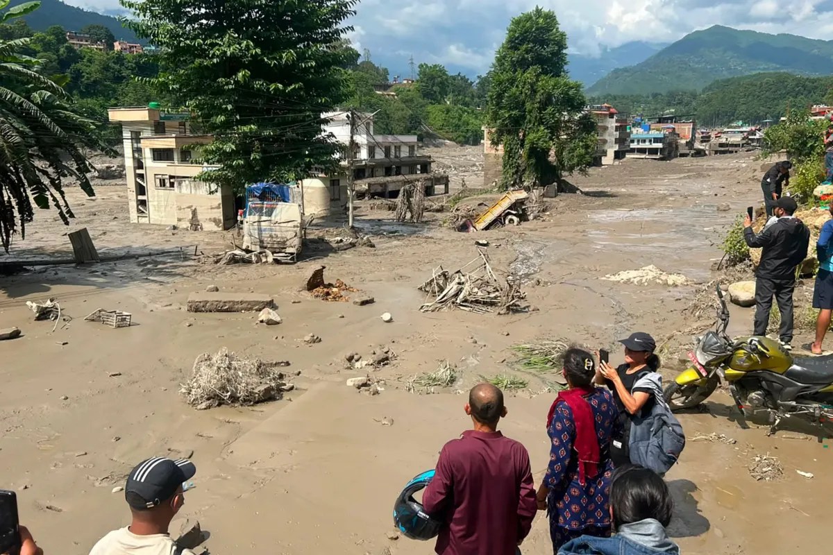
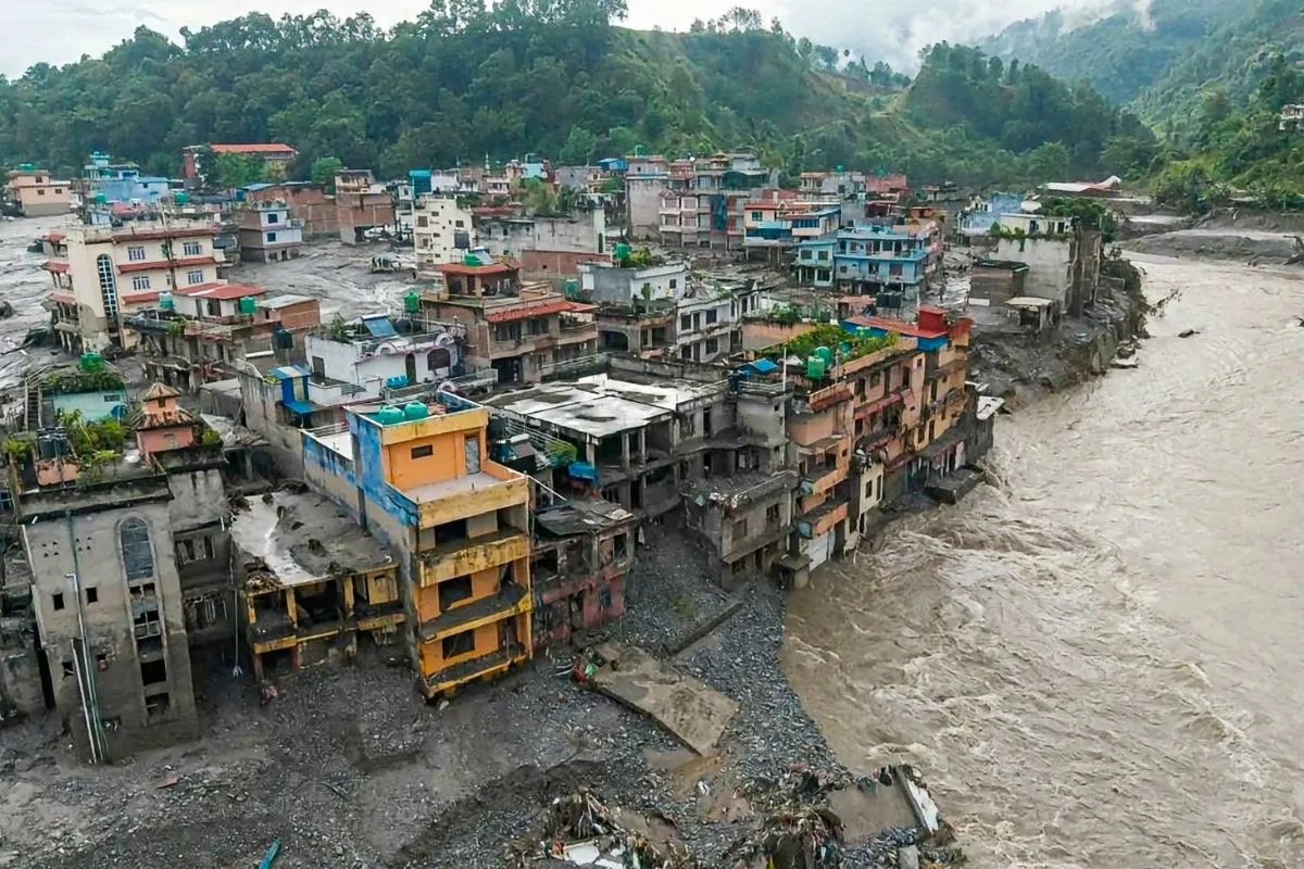
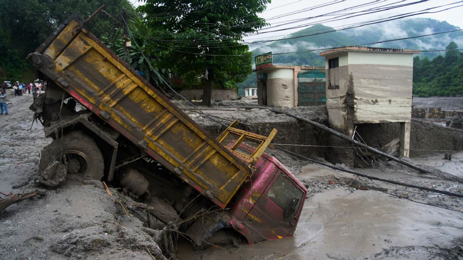
High-altitude hydrology in the Himalayas is governed by mechanical instability and hydro-geological feedback loops that traditional disaster management frameworks fail to capture. When an ice-rock avalanche near the Langtang Lirung massif triggered a catastrophic flood across the Nepal-China border, it exposed structural blind spots in regional risk assessment. The event was neither a simple meteorological anomaly nor an isolated seismic occurrence. It was a predictable systemic failure caused by the intersection of thawing permafrost, high-energy debris flows, and cross-border river basin management deficits.
Deconstructing the mechanics of this disaster requires examining the three core vectors that dictate Himalayan flash floods: mass movement initiation, hydraulic damming, and transboundary propagation velocity.
The Mechanics of Mass Movement Initiation
Mountain slopes in the Tibet-Nepal border region experience accelerated destabilization due to thermal degradation of permafrost and glacial recession. The initial trigger was not a traditional water-driven glacial lake outburst, but a massive ice-rock avalanche. Seismic signatures analyzed by the United States Geological Survey confirmed that a structural collapse of a glaciated cliff released between fifty million and one hundred million cubic meters of rock and ice.
This mass did not slide passively; it transformed into a high-energy debris flow. The kinetic energy generated was equivalent to a moderate-to-large seismic event, which initially confounded monitoring networks that misread the ground motion as an earthquake. As the debris cascaded down into the Bhote Koshi and Trishuli river corridors, it picked up heavy sediment, boulders, and water, multiplying its destructive volume exponentially.
The primary analytical failure in regional preparedness lies in treating slopes and glaciers as static static features. In high-altitude environments, structural integrity degrades non-linearly. Temperature anomalies penetrate permafrost layers, reducing the shear strength of bedrock joints. When a threshold is breached, millions of tons of material detach instantaneously, bypassing standard early warning metrics designed to track gradual rainfall accumulation or slow river swelling.
The Hydraulic Economics of Barrier Lakes
The secondary hazard that materialized in the wake of the initial avalanche demonstrates the danger of secondary blockage formations. When the avalanche debris slammed into the confluence of the Chhochen and Purepu Tsangpo rivers on the Tibetan side, it acted as an impromptu landslide dam, creating a barrier lake.
This barrier lake introduced an immediate, highly volatile hydrological variable:
- Water accumulation outpaced natural seepage, swelling the reservoir past two million cubic meters within forty-eight hours.
- Inflow forecasts predicted an additional three million cubic meters of water over a subsequent three-day window, saturating the temporary earth structure.
- The absence of a controlled spillway transformed the impoundment into an unmanaged pressure vessel, forcing emergency evacuations and suspending rescue operations.
Landslide dams created by high-energy avalanches possess a high failure probability because the constituent material is poorly sorted, highly permeable, and structurally unsound. Unlike engineered concrete dams, these natural barriers lack internal drainage filters or reinforced overflow channels. When the water level exceeds the crest, localized piping and surface erosion rapidly carve through the loose debris, resulting in a catastrophic breach that sends a secondary flood wave downstream with minimal transit time.
Transboundary Propagation and Response Latency
Geographical borders do not stop water, but political and administrative jurisdictions routinely fragment emergency response. The headwaters for many critical river systems draining into Nepal originate within the Tibet Autonomous Region of China. This creates a structural information asymmetry.
When a disaster originates upstream, downstream communities in Nepal operate under an extreme time deficit. In the recent disaster, the surge crossed the international boundary and reached downstream settlements within minutes. Hydrological monitoring stations located entirely within one nation fail to provide adequate lead time if telemetry and raw data are not shared across borders in real time.
The propagation velocity of a debris flow in steep Himalayan gorges can exceed thirty kilometers per hour. At this speed, manual verification, bureaucratic sign-offs, and hierarchical communication chains introduce fatal bottlenecks. Automated sensor networks coupled with direct, cross-border satellite telemetry represent the only viable countermeasure to this velocity gap, yet diplomatic and infrastructural frameworks for such integrated systems remain underfunded and incomplete.
Infrastructure Vulnerability and the Hydropower Bottleneck
Economic development along Himalayan river corridors has accelerated, introducing dense clusters of infrastructure into high-risk hydraulic zones. Hydropower projects, bridges, and access roads are routinely placed in narrow gorges where energy dissipation is highest during a flood event.
Projects such as the Upper Trishuli-1 Hydropower Project found critical access tunnels and portals choked under meters of mud and debris. Subsurface infrastructure in narrow river valleys acts as a sediment trap. When a high-volume debris flow encounters artificial structures, the cross-sectional area of the channel is effectively constricted, forcing the water level to spike violently—in some instances rising up to nine meters within half an hour. This dynamic converts linear river channels into high-energy battering rams that completely eradicate concrete piers, reinforcement steel, and surrounding settlements.
Strategic Operational Shift for High-Risk Watersheds
Mitigating future catastrophic failures along the Nepal-China border and similar Himalayan terrain requires moving away from reactive search-and-rescue postures and toward automated structural interventions.
- Deploy real-time acoustic and seismic sensor arrays across high-altitude hanging glaciers to detect mass movement initiation prior to slope failure.
- Establish automated, bilateral data-sharing protocols between Chinese upstream monitoring stations and Nepali downstream disaster management authorities to bypass administrative delays.
- Mandate geomorphological stress-testing for all future infrastructure projects sited within high-risk river corridors, factoring worst-case debris flow volumes rather than standard historical flood levels.
- Construct engineered diversion channels and controlled spillways at known landslide-prone confluences to prevent the unmanaged accumulation of barrier lake volumes.