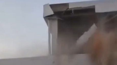
Seismic events in Southern Spain do not occur in a vacuum. When a moderate-to-strong tremor strikes Granada, the immediate surface manifestation—tourists evacuating hospitality venues, structural panic in urban cores, and infrastructure checks—is merely the visible output of a complex tectonic fault system. To understand why a shallow-focus earthquake in Andalusia triggers widespread behavioral disruption disproportionate to its magnitude, one must deconstruct the interaction between geological mechanics, regional building typology, and the economics of tourism mobility.
The standard news cycle reduces these events to fragmented snapshots of structural damage and displaced travelers. This analysis replaces reactive panic narratives with a structured breakdown of tectonic mechanics, the cost function of municipal vulnerability, and the behavioral economics of sudden-onset environmental shocks. If you enjoyed this post, you might want to read: this related article.
The Tectonic Architecture of the Betic Cordillera
The seismic profile of Granada is governed by regional plate convergence. The African Plate pushes northward against the Eurasian Plate at an approximate rate of four to five millimeters per year. This compression is not absorbed smoothly; instead, it is accommodated by a complex network of crustal faults embedded within the Betic Cordillera.
Granada sits within a tectonic depression known as the Granada Basin. This basin is bounded by major active fault systems, including the Padul Fault to the south. When strain accumulation along these crustal segments exceeds the frictional resistance of the fault plane, sudden slip occurs. For another angle on this development, see the latest coverage from BBC News.
Three physical variables dictate the surface impact of this slip:
- Hypocentral Depth: Shallow earthquakes, defined as those with a focus of less than fifteen kilometers, compress seismic energy into a narrower crustal volume before it reaches the surface. This proximity amplifies peak ground acceleration.
- Basin Amplification: The Granada Basin is filled with soft, unconsolidated sedimentary deposits. Seismic waves traveling through dense bedrock slow down significantly upon entering these loose basin sediments. This velocity reduction forces an increase in wave amplitude, converting low-frequency regional energy into high-amplitude localized shaking.
- Directivity Effects: Rupture propagation along the fault plane often focuses seismic energy in a preferred direction, creating localized lobes of high damage that do not correlate symmetrically with distance from the epicenter.
Understanding these mechanics explains why a magnitude 4.5 or 5.0 event in this specific geography produces surface intensities that mimic much larger tectonic events in stable continental shields. The geology acts as an amplifier rather than a dampener.
The Vulnerability Index of Urban Infrastructure
Physical damage during a Granada earthquake is a direct function of building stock resilience intersecting with seismic wave frequencies. The built environment of Andalusia presents a distinct risk profile due to a bimodal distribution of construction eras.
On one side of the ledger are historical masonry structures, particularly in neighborhoods like Albaicín and the commercial center. These buildings utilize unreinforced stone, brick, and heavy timber floor diaphragms. Unreinforced masonry exhibits near-zero tensile strength. When subjected to the horizontal shear forces generated by seismic waves, these walls crack diagonally along principal stress trajectories. Without a rigid floor diaphragm to tie the structural walls together, out-of-plane wall failure becomes the primary collapse mechanism.
On the other side are modern reinforced concrete frame buildings constructed after the implementation of modern Spanish seismic codes, specifically the NCSE-02 and subsequent updates. These structures possess ductility—the capacity to deform inelastically without sudden brittle fracture. However, code compliance is historically uneven across older mid-century infill developments, where soft-story configurations (commercial ground floors with large open glass facades beneath residential concrete blocks) create severe torsional vulnerabilities.
The vulnerability of this infrastructure can be modeled through a simple risk equation where risk equals the product of hazard, exposure, and vulnerability. While the hazard (tectonic slip) and exposure (dense population and tourist density) remain constant, vulnerability is the only variable susceptible to engineering intervention. Retrofitting unreinforced masonry with steel tie-rods, injecting epoxy into micro-fractures, and installing base isolation pads on critical infrastructure represent the capital expenditure required to flatten the structural damage curve.
The Behavioral Economics of Tourist Displacement
When a tremor disrupts Granada, the immediate reaction of the transient population—tourists, business travelers, and temporary residents—diverges sharply from that of the local populace. This divergence is driven by asymmetry in risk perception and spatial familiarity.
Locals possess an internalized mental map of regional seismicity, historical baseline frequencies, and structural norms. They understand that a moderate tremor rarely signals structural collapse for modern buildings. Tourists, conversely, experience an informational vacuum combined with an acute loss of environmental control.
This triggers a rapid cascading sequence:
- Acoustic and Kinematic Shock: The sudden low-frequency rumble accompanied by lateral swaying disrupts spatial equilibrium, triggering an immediate orienting reflex and activation of the sympathetic nervous system.
- Information Asymmetry: In the immediate post-event window of zero to thirty minutes, official seismic data (exact magnitude, depth, and epicenter) is unavailable or inaccessible to non-Spanish speakers. This creates a high-uncertainty environment.
- Heuristic Decision-Making: Deprived of data, transient populations rely on availability heuristics. Seeing locals evacuate buildings or observing falling roof tiles from older masonry structures, tourists conflate localized superficial damage with systemic catastrophic failure.
- Liquidation of Itineraries: The behavioral response transitions from shelter-in-place to immediate spatial flight. Hotels, restaurants, and cultural landmarks like the Alhambra experience sudden operational pauses for mandatory safety inspections, accelerating the physical exodus of visitors into open public squares.
This mass movement creates secondary logistical friction. Telecommunication networks experience congestion spikes as both locals and tourists attempt to contact relatives or access news feeds, temporarily overloading cellular towers. Transport nodes face acute demand surges as travelers attempt to modify outbound transit schedules.
The Municipal Cost Function of Seismic Events
Emergency management in historic cities like Granada operates under severe structural constraints. The medieval street layouts of the historic quarters were optimized for defense and pedestrian shade, not for post-disaster vehicular ingress.
When an earthquake prompts structural inspections, municipal authorities face a severe resource allocation problem. Emergency services must triage assessment requests across three distinct tiers:
- Tier One: Critical infrastructure, including hospitals, potable water treatment plants, electrical substations, and major access bridges. Failure here cascades into systemic societal paralysis.
- Tier Two: High-density public assembly zones, schools, and major tourist hubs. Rapid clearance is required to prevent secondary casualties from aftershocks dislodging damaged cornices, tiles, or chimneys.
- Tier Three: Private residential and commercial stock. Homeowners and business operators often experience severe inspection backlogs, delaying economic restart.
The economic cost function of a moderate seismic event comprises direct repair expenditures, business interruption losses during the inspection window, and indirect brand erosion within the competitive Mediterranean tourism market. While physical damage to modern structures is typically localized to non-structural elements—such as partition walls, suspended ceilings, and glass facades—the economic friction of downtime often exceeds the physical repair bill.
Structural Preparedness and the Limits of Mitigation
Mitigation strategies in seismically active urban basins must confront the law of diminishing marginal returns. It is economically unviable to engineer every structure to withstand maximum credible earthquakes without sustaining any damage. Instead, contemporary seismic engineering shifts the objective from damage prevention to life safety and operational resilience.
For Granada, this requires shifting from a posture of post-disaster remediation to continuous structural monitoring. Dense arrays of broadband seismometers and high-sensitivity accelerometers installed across the Granada Basin can provide real-time ground motion data. Coupled with automated structural health monitoring sensors embedded in high-risk historic monuments and modern critical assets, municipal authorities can transition from blanket evacuation protocols to targeted, zone-specific evaluations within minutes of an event.
The primary limitation of this approach is legacy stock. You cannot demolish the Albaicín to build modern base-isolated concrete frames without destroying the cultural heritage that drives the regional economy. Preservation mandates conflict directly with rigorous seismic retrofitting standards, forcing engineers to rely on discreet, low-impact interventions that improve ductility without altering visual fabric.
Future resilience in historic seismic zones like Granada depends entirely on closing the loop between real-time data ingestion and automated public communication. When the next slip occurs along the Betic fault network, mitigating the chaos of the tourist exodus requires preemptive informational infrastructure just as much as it requires steel reinforcement.