You pack the essentials for a day at the ocean: sunscreen, a towel, and your phone. You probably use that phone to capture the perfect sunset or a candid shot of your friends in the surf. But right now, researchers are using those exact casual snapshots to solve one of the trickiest problems in modern climate science.
It turns out your smartphone is a highly accurate coastal monitoring device.
Coastal scientists face a massive logistical headache. Beaches are incredibly dynamic systems. They change by the hour. A single storm can rip away sixty meters of sand overnight, only for the beach to slowly rebuild itself over the following months. Tracking this constant shifting requires constant eyes on the ground. Traditional surveying methods involve expensive GPS equipment, specialized drones, or researchers physically driving out to remote shorelines. It costs a fortune, and scientists simply cannot be everywhere at once.
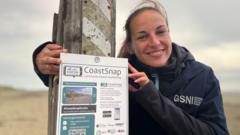
That is where you come in. By crowdsourcing public photography, a global initiative called CoastSnap is turning ordinary beachgoers into active field researchers.
The Precision Machine Hiding in a Simple Metal Bracket
If you walk along coastal trails or look near beach access points from California to Cornwall, you might spot a random stainless-steel cradle bolted to a fence post or viewing platform. It looks almost too simple to be scientific. There are no electronics, no solar panels, and no moving parts. It is just a fixed smartphone mount with an instructional sign.
But that low-tech bracket is actually a precision data-collection tool.
When you slide your phone into the cradle and snap a photo of the shoreline, the mount forces your camera into a specific, predetermined height and angle. You do not use zoom, you do not shoot a panorama, you just take a standard photo and upload it via a QR code. Because every single person uses the exact same mount, every photo is taken from the exact same spatial coordinate.
This consistency allows scientists to use a technique called photogrammetry. Specialized computer algorithms analyze the pixels in your smartphone photo and mathematically map them against known geographic landmarks in the background, like distant headlands or rocky outcrops. The software essentially warps and flattens your snapshot, converting it into a miniature, ultra-high-resolution satellite image.
Because your phone automatically logs the exact timestamp of the image, researchers can cross-reference the photo with local tide charts. They filter out the daily rise and fall of the water to isolate the actual baseline movement of the sand.
Honestly, the results are stunningly accurate. Data collected from these public photo stands matches the precision of professional, expensive surveys done with high-end GPS rigs.
Tracking the Triggers of Coastal Erosion
We know that rising sea levels and shifting storm tracks are putting immense pressure on global coastlines. But managing a beach requires hyper-local data. Scientists need to know the baseline. Is a beach currently eroding beyond its natural cycle, or is it just undergoing a standard seasonal shift?
Just a minor increase in sea level changes everything. A mere 20 to 30 centimeters of extra water level can translate into tens of meters of landward beach erosion during a storm. A tempest that a beach could easily withstand thirty years ago can now completely strip a shoreline bare because the base water level is higher.
Having a continuous stream of daily photos helps researchers build a long-term visual ledger. In places like Prince Edward Island in Canada, CoastSnap stations captured the exact structural damage inflicted by Hurricane Fiona, and researchers now use the ongoing public uploads to monitor how the sand dunes are recovering. Over in Ghana, West Africa, local school groups use the stations to track how massive influxes of sargassum seaweed impact the immediate shoreline and local fishing communities.
This is not just an academic exercise. The data feeds directly into predictive numerical models used by city planners and engineers. If a local government is trying to decide whether to invest millions of dollars into sand nourishment programs to artificially stabilize a beach, or if they need to build coastal defense structures, they rely on this crowdsourced data to make the call.
How to Do Citizen Science Right on Your Next Vacation
Participating in this global network does not require a background in marine biology. It takes about thirty seconds while you are out for a walk. But you do need to follow a few basic rules to make sure your data is actually usable for the researchers on the backend.
- Ditch the filters. Keep your camera settings entirely standard. Algorithmic adjustments, filters, or forced night modes can mess with the pixel-mapping software.
- No panoramas or wide-angle overrides. Trust the fixed mount. The software relies on the standard focal length of a normal photo to calculate distances accurately.
- Keep people out of the frame. While scientists joke that they get plenty of accidental family portraits, a group of people blocking the shoreline means the algorithm cannot map the intersection of the water and the sand. Snap your family photo first, then take a clean one of just the landscape for the database.
- Submit via the official channel. Don't just post it to your personal social media feed with a hashtag. Scan the QR code on the physical station sign to drop it directly into the regional database where the photogrammetry software can grab it.
The biggest misconception about climate science is that it only happens in multi-million-dollar labs with supercomputers. Sometimes, it just takes a piece of steel, a smartphone, and a regular citizen willing to pause their morning walk for a single click. Look for a mounting station the next time you hit the coast. Your camera roll holds more scientific value than you think.