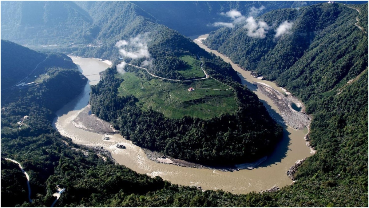
Building the world's largest dam on top of a major tectonic fault line sounds like the plot of a bad disaster movie. Yet, that's exactly what's happening right now in the remote, mist-shrouded canyons of Tibet. Beijing is pushing ahead with its massive Medog Hydropower Station on the Yarlung Tsangpo river, just 50 kilometers from the Indian border near Arunachal Pradesh. It's a project designed to dwarf the Three Gorges Dam, but it has hit a massive, unexpected roadblock.
The warning isn't coming from external critics or political rivals. It's coming straight from China's own state-backed scientists. If you found value in this post, you might want to check out: this related article.
A joint research paper published by geologists affiliated with the state-owned China Geological Survey, the Chengdu University of Technology, and regional observation stations dropped a massive bombshell. The proposed site for this $137-billion mega-project sits directly over the Paizhen Fault. This isn't some ancient, dormant scar in the earth either. It's an active tectonic fault zone that has been shifting since the Ice Age. Building here means erecting a colossal concrete wall over a highly unstable foundation.
If you want to understand why this project matters, look at the sheer scale of what China is trying to pull off. The plan is to capture the immense energy of the river as it whips around the Great Bend, dropping thousands of feet through the deepest gorge on Earth. The project aims to generate roughly 300 billion kilowatt-hours of electricity every single year. That's about three times the output of the Three Gorges Dam. It's a massive pillar of Beijing's clean energy blueprint. For another perspective on this event, refer to the recent coverage from NPR.
But the geology of the eastern Himalayas doesn't care about national energy targets.
The Science Behind the Threat
The Paizhen Fault is a direct product of the ongoing, violent collision between the Indian and Eurasian tectonic plates. This collision built the Himalayas, and it keeps the entire region in a state of permanent geological restlessness. According to the published data, the fault has moved as recently as 9,500 years ago, which is basically yesterday in geological time. The area was also rocked by a powerful 6.9 magnitude earthquake in 2017.
The Chinese research team noted that the fault has severely fractured the surrounding rock, dramatically weakening its mechanical properties. When you fracture bedrock, it loses its capacity to hold massive weight.
Worse still is the issue of slope stability. The terrain lining the proposed reservoir has a loose structure with very weak cohesion. When you submerge that kind of weak, crumbly rock under a massive reservoir, the water seeps deep into the cracks. This build-up of pore pressure acts like a lubricant. Combine that soggy, loose terrain with ongoing fault movements or a sudden earthquake, and you get catastrophic, large-scale slope collapses.
Think millions of tons of rock and mud sliding instantly into the water. This can trigger displacement waves—essentially inland tsunamis—that can overtop or severely compromise the dam structure.
Downstream Panic in India and Bangladesh
The scientific warning adds a scary new dimension to an already tense geopolitical standoff. The Yarlung Tsangpo doesn't stay in Tibet. It rushes down into India, where it becomes the Siang and then the Brahmaputra in Assam, before emptying through Bangladesh into the Bay of Bengal. It supplies roughly 30 percent of India's freshwater resources and serves as a literal lifeline for millions of farmers.
Downstream communities are terrified, and honestly, who can blame them? Tribal groups in Arunachal Pradesh have been protesting the project since construction activities began last year.
If a catastrophic structural failure occurs due to an earthquake or a massive landslide, the resulting wall of water would tear through Arunachal Pradesh and Assam. It would wipe out entire cities and displace millions of people down the line. Even during normal operations, Indian scientists worry that the dam will mess with seasonal water flows, leading to artificial droughts in the dry season and flash floods during the monsoons.
Some security analysts argue that the dam gives Beijing a literal water chokehold over northeastern India. While economists note that trying to completely divert the river's flow would backfire on China by causing massive sediment accumulation and upstream flooding, the risk of accidental catastrophe is now the real talking point.
What Happens Next
The Chinese Geological Survey report didn't explicitly call for scrapping the Medog project. Stopping a top-tier state priority isn't really how things work there. Instead, the scientists urged engineers to heavily reinforce the mountain slopes and build massive retaining barriers to mitigate landslide risks.
Engineering your way out of an active Ice Age fault line is an incredibly expensive, high-stakes gamble. Crews will have to deploy massive rock-bolting networks, inject specialized grouting to bind the fractured bedrock, and constantly monitor the fault line with high-precision seismic sensors. Every single structure, from the main barrage to the 30-kilometer-long water diversion tunnels bored through the mountains, will have to be over-engineered to withstand massive seismic shifts.
For India and Bangladesh, the play here is to use this Chinese-backed scientific study as diplomatic leverage. New Delhi has already been fortifying its positions by proposing its own massive 11,000-megawatt Lower Siang project in Arunachal Pradesh to help regulate water flows and counter Beijing's upstream moves.
Now, regional diplomats can push for an official, transparent transboundary water-sharing framework. Pointing out that China's own scientists think the project is a ticking geological bomb is a powerful argument for demanding real-time data sharing and joint safety inspections. Beijing wants clean power for its growing industrial sectors, but it will have to decide if building the world's biggest dam is worth the risk of a self-inflicted Himalayan disaster.