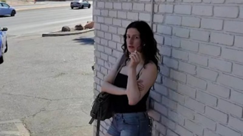
The transition of an individual from "active traveler" to "missing person" is increasingly documented not by physical evidence, but by a fragmented trail of digital assets. When a tourist vanishes, crowd-sourced social media video often becomes the primary timeline anchor for law enforcement and open-source intelligence (OSINT) analysts. However, the current methodology for analyzing these digital artifacts is fundamentally flawed. Relying on superficial visual confirmation introduces cognitive bias and risks misallocating critical search-and-rescue resources.
To maximize the utility of open-source video data, investigators must apply a rigorous, structured analytical framework. This requires deconstructing a video asset into its component data layers, establishing absolute chronological anchors, and calculating spatial probability distributions.
The Tri-Layer Framework of Digital Video Verification
A social media video is not a monolithic piece of evidence. It is a composite asset containing three distinct layers of information, each requiring a specific validation protocol. The breakdown of these layers determines the evidentiary weight of the asset.
1. The Metadata Layer (The Digital Registry)
Metadata represents the underlying code generated by the capturing device and the hosting platform. While raw files contain Exchangeable Image File Format (EXIF) data—including precise GPS coordinates, camera serial numbers, and creation timestamps—social media platforms routinely strip this information during ingestion to protect user privacy. Analysts must therefore pivot to secondary metadata network analysis:
- Upload Timestamp vs. Capture Timestamp: The exact minute a video is posted rarely correlates with its creation. Determining the delta between upload and capture requires cross-referencing environmental variables or platform-specific sequential ID generation.
- Compression Artifacts: Re-uploaded or altered video undergoes structural degradation. Quantifying the macroblock compression reveals whether the footage is original or a secondary screen recording, which introduces a margin of temporal error.
2. The Environmental Layer (The Physical Context)
When metadata is stripped, the physical environment captured within the frame becomes the primary source of truth. This process utilizes shadow analysis (shadow carology) and meteorological triangulation to establish a definitive temporal window.
- Solar Geolocation: By calculating the angle and length of shadows cast by fixed structures (such as light poles or buildings), analysts can determine the sun's azimuth and elevation. Placed into astronomical algorithms like the NOAA Solar Position Calculator, this establishes the true local time of the recording, independent of device settings.
- Episodic Environmental Markers: Micro-events within the footage—such as a specific public transit vehicle number, localized weather patterns, or unique commercial signage—provide hard constraints on the timeline when cross-referenced with municipal logs and local business registries.
3. The Behavioral Layer (The Subject State)
The final layer examines the missing individual’s biometrics, gait, and interaction with the environment. This layer establishes whether the subject was operating under duress, experiencing cognitive disorientation, or altering their established travel patterns.
Chronological Anchoring and the Fallacy of Proximal Sightings
The core failure of standard media reporting on missing tourists is the conflation of a "last known post" with a "last known location." This introduces an analytical error known as temporal drift.
[Capture Event] ───(Temporal Drift Delta)───> [Upload Event] ───> [Disappearance Window]
To systematically eliminate this drift, investigators use a strict spatial-temporal matrix. This matrix categorizes digital sightings based on two variables: Certainty of Identity ($C_i$) and Precision of Time ($P_t$).
The value of an asset degrades exponentially the longer the gap between the verified capture time and the reported disappearance window. For instance, a high-definition video showing a tourist at a landmark is highly valuable only if the solar analysis places the footage within a tight window prior to the cessation of the individual's financial and cellular activity. If the temporal drift delta exceeds 48 hours, the video ceases to be an actionable search anchor and becomes merely a historical baseline for behavioral mapping.
This creates a structural bottleneck in investigations. Media saturation of a specific video often skews public tips toward the location shown in the footage, diverting ground resources away from the actual, statistically probable zone of disappearance.
Spatial Probability Distribution: The Cost of Misallocated Search Radii
Once a video is verified and anchored in time, it must be translated into a geographic search area. This is achieved by calculating a Probability of Area ($POA$) using modified search-and-rescue (SAR) kinematics.
The starting point is the Last Known Position ($LKP$) derived from the verified video. From this coordinate, a probability distribution is generated based on three primary variables:
- Terrain Friction Coefficients: Moving through a dense urban center, a rugged mountain trail, or an arid desert alters the maximum potential distance a subject could travel on foot per hour.
- Transportation Access Points: The proximity of the $LKP$ to transit hubs, car rentals, or rideshare zones exponentially expands the search radius, shifting the model from a linear foot-search circle to a nodal network distribution.
- Subject Profile Dynamics: Historical data regarding lost wanderers indicates that terrain choices (e.g., following downhill paths versus seeking high ground) vary predictably by demographics, psychological state, and fitness levels.
Without applying these friction coefficients to the $LKP$, search teams rely on simple circular radii. A standard 10-kilometer radius circle covers over 314 square kilometers. By applying terrain friction and network analysis to the data extracted from the social media video, that search area can frequently be optimized down to high-probability corridors comprising less than 15% of the total area, drastically reducing the time-to-discovery metric.
Systemic Limitations of Open-Source Intelligence in Active Enquiries
While structured video analysis yields high-value data, the methodology is constrained by distinct operational boundaries that analysts must explicitly acknowledge.
First, crowd-sourced digital evidence is highly vulnerable to algorithmic bias. Social media distribution algorithms prioritize high-engagement content rather than chronologically relevant data. Consequently, the footage most visible to the public—and often to local authorities—is frequently the most sensational, not the most analytically useful.
Second, the proliferation of generative AI and sophisticated video editing suites introduces the risk of synthetic corroboration. Malicious actors or entities seeking attention can alter timestamps, manipulate backgrounds, or fabricate sightings entirely. Every video asset must pass deep-layer forensic verification before it alters the allocation of physical rescue teams.
Tactical Protocol for Initial Asset Ingestion
When a digital asset emerges depicting a missing person prior to their disappearance, the investigative command must execute the following protocol immediately:
- Isolate the Source: Secure the original network transport stream of the video to prevent further compression and loss of structural data during platform re-encoding.
- Execute Shadow Carology: Extract three distinct frames showing fixed vertical structures and run solar positioning models to confirm local time within a 15-minute margin of error.
- Establish the Friction Bounds: Map the physical coordinate of the footage against a localized Geographic Information System (GIS) database to calculate maximum pedestrian travel boundaries for the subsequent 4, 8, and 12-hour intervals.
- Audit Cellular Handshakes: Cross-reference the verified video timeline against the subject's Call Detail Records (CDRs) and cell tower pings to identify any anomalies between physical presence and device location.
Instead of treating social media footage as a narrative centerpiece, operational strategy dictates treating it purely as a data-generation event. The objective is never to tell a story, but to constrain a coordinate system.