United Kingdom coastal flood exposure represents a compounding structural liability driven by thermal expansion, ice-sheet mass loss, and historical asset concentration in low-elevation flood zones. Standard risk assessments frequently underestimate the systemic threat by modeling sea level rise as a static linear variable rather than an integrated forced multiplier on storm surge frequencies, tidal resonance, and hard-defense degradation rates. Managing this transition requires moving away from reactive emergency response toward an explicit economic evaluation of defense maintenance versus managed retreat.
The Tripartite Structural Vulnerability Model
Coastal flooding risk in the British Isles operates across three interlocking physical and socioeconomic vectors. Evaluating these vectors reveals why incremental policy adjustments fail to mitigate long-term exposure.
Vector 1: Anthropogenic Sea Level Elevation and Tidal Amplification
Global mean sea level elevation alters baseline water depth, which fundamentally reshapes coastal hydrodynamics. Increased bathymetric depth decreases bottom friction, allowing tidal waves to propagate inland with greater amplitude and higher velocity.
- Thermal Expansion: Oceanic absorption of excess thermal energy decreases water density, increasing volume per unit mass.
- Glacial and Ice-Sheet Discharges: Land-based ice melt introduces freshwater mass into northern ocean basins, altering regional gravitational attraction and ocean circulation patterns like the Atlantic Meridional Overturning Circulation.
- Tidal Resonance Shifts: As local bathymetry alters, estuaries experience altered natural resonant frequencies, turning previously manageable high-tide events into severe inundation thresholds.
Vector 2: Hydrodynamic Forcing and Storm Surge Convergence
Extreme water level events occur when baseline sea level rise coincides with low atmospheric pressure systems and wind-driven wave setup. Low barometric pressure causes the sea surface to bulge upward, while sustained high-velocity winds push surface water toward shallow coastal shelves. When these atmospheric conditions align with spring high tides—known as syzygy—the resulting surge overtops existing defenses even if storm intensity remains unchanged relative to historical norms.
Vector 3: Geomorphological Degradation and Subsidence
The UK landmass experiences ongoing post-glacial rebound. Southern and eastern England undergo gentle tectonic subsidence, dropping relative land elevation while northern and western regions experience minor uplift. This creates an asymmetric risk distribution where the regions possessing the highest density of agricultural land and economic infrastructure—such as the Thames Estuary and the Fens—face the highest relative sea level rise rates.
Defense Degradation and The Economic Cost Function
Hard engineering defenses like seawalls, revetments, and tidal barriers face progressive mechanical fatigue. The structural integrity of concrete and masonry sea defenses declines exponentially under continuous exposure to wave impact, saltwater intrusion, and freeze-thaw cycles.
Total Flood Risk = (Hazard Frequency × Asset Exposure × Structural Vulnerability) - Mitigating Defense Capacity
The financial burden of maintaining hard defenses increases non-linearly as sea levels rise. Water depth directly governs maximum wave height near the shore; a minor increase in local depth allows significantly larger waves to strike coastal structures without breaking beforehand.
The Breakwater Failure Cascade
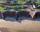
- Scour Formation: Increased wave energy erodes sediment at the foundation toe of seawalls.
- Structural Undermining: Loss of toe stability induces structural tilting or cracking.
- Overtopping Erosion: Unbroken waves crest over the defense apex, eroding the unarmored landward embankment.
- Catastrophic Breach: Hydrostatic pressure from the seaward side combined with landward foundation failure collapses the primary defense segment.
Attempting to continuously elevate and reinforce hard barriers across thousands of kilometers of coastline introduces severe capital allocation inefficiencies. Beyond critical physical thresholds, the economic cost of maintaining defenses exceeds the net present value of the protected real estate assets.
Policy Trilemma: Hard Engineering, Soft Mitigation, and Managed Realignment
Infrastructure planners face three mutually exclusive strategic pathways for any given coastal segment. Selecting an approach requires calculating localized asset density, ecological value, and geotechnical feasibility.
Strategy A: Hold the Line (Hard Engineering)
This strategy involves constructing and maintaining physical barriers including sea walls, rock armor, and surge gates.
- Capital Allocation: High upfront capital expenditure and compounding maintenance costs.
- Failure Mode: Low frequency, high severity. Defense failure results in sudden catastrophic flooding behind the barrier.
- Long-Term Feasibility: Economically viable only for high-density urban nodes like Central London, protected by major infrastructure like the Thames Barrier.
Strategy B: Managed Realignment (Deliberate Inundation)
Managed realignment breaches existing front-line defenses to allow tidal waters to flood designated low-lying land, creating intertidal habitats such as salt marshes.
- Capital Allocation: Moderate land acquisition costs offset by negligible long-term maintenance expenditure.
- Failure Mode: Continuous controlled conversion; eliminates catastrophic breach risk.
- Long-Term Feasibility: Optimal for agricultural zones, rural communities, and estuaries where natural sediment accumulation attenuates wave energy naturally.
Strategy C: Accommodate and Adapt (Building Resilient Infrastructure)
This option permits flooding while modifying urban planning codes to mandate elevated foundations, flood-proof building materials, and resilient drainage networks.
- Capital Allocation: Distributed private and public expenditure spread across building retrofits and infrastructure cycles.
- Failure Mode: High frequency, low severity. Requires persistent operational adjustment and temporary transport disruptions.
- Long-Term Feasibility: Effective for secondary commercial districts and low-density coastal settlements.
Systemic Impairment of Insurance Markets and Mortgage Assets
The transition from predictable cyclical flood events to systemic coastal exposure threatens the solvency of real estate financing models across vulnerable UK districts.
Property valuation assumes long-term structural permanence and access to affordable private insurance. As regional flood risk maps update to reflect accelerating sea level rise, insurers recalculate actuarial risk models. When expected annual damages cross operational profitability thresholds, insurers withdraw coverage or raise deductibles to prohibitive levels.
Uninsured or underinsured real estate cannot satisfy commercial mortgage lending conditions. Lenders face elevated default risks while the underlying collateral value depreciates. This dynamic risks generating localized equity write-downs, concentrated municipal tax base erosion, and distressed asset sales in low-lying coastal jurisdictions.
Strategic Action Plan for Regional Infrastructure Planners
Municipalities and asset managers must execute a multi-phase real estate and infrastructure audit to mitigate exposure before asset devaluation escalates.
- Conduct High-Resolution Elevation Modeling: Replace regional topographical estimates with light detection and ranging (LiDAR) data mapped against hyper-local surge models.
- Audit Defense Toe Stability: Inspect underwater foundations of existing seawalls to identify active scouring before structural failure occurs.
- Classify Land-Use Zones by Strategic Life Expectancy: Segment municipal zones into 30-year, 60-year, and 90-year viable horizons based on hydrodynamic forcing projections.
- Initiate Phased Managed Retreat Programs: Acquire low-density agricultural fringe land ahead of defensive failure to establish natural buffer zones.
- Reallocate Capital to Adaptive Infrastructure: Redirect funds from non-viable hard barrier extension projects toward resilient utility networks, elevated transport corridors, and natural sediment retention basins.