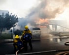
Brush fires destroy homes across Southern California not simply because hot weather arrives and dry wind blows, but because decades of land-use decisions, aging infrastructure, and market incentives have pushed neighborhoods directly into high-hazard fuel corridors. When temperatures spike and humidity collapses, fast-moving brush fires overwhelm local suppression capacities and turn residential edges into ignition zones. The heat wave grabs the headlines. The structural trap underneath is what actually burns the block.
Anyone who has covered wildland-urban disasters long enough recognizes the familiar choreography. Sirens wail along canyon roads before the smoke plume even finishes rising. Anchors talk about extreme heat, low relative humidity, and erratic winds as if those conditions were sudden anomalies rather than recurring features of Southern California climate and geography. Then comes the shock that structures were lost despite modern firefighting fleets, updated building codes, and aggressive initial attacks.
That shock usually lasts about forty-eight hours. After that, the public conversation slides back into routine weather talk while the underlying mechanics remain untouched.
Why Heat Waves Only Trigger What Policy Prepared
Heat does not create brush fires out of thin air. Heat dries fine fuels, lowers live fuel moisture, and primes landscapes that have spent months or years accumulating dense chaparral, coastal sage scrub, and non-native flashy grasses. Once ignition happens—whether from a downed power line, a spark off a vehicle undercarriage, a backyard tool, or human negligence—dry heat accelerates combustion and reduces the margin for error before a small patch of smoking grass becomes a wind-driven wall of flame.
Still, blaming a hot spell for destroyed neighborhoods misses the larger story. Weather is the match and the fan. Urban planning and regional growth patterns supply the row of dominoes.
Across Southern California, sprawling subdivisions have repeatedly expanded into foothills, steep canyons, and brush-choked valleys where fire has always been an ecological constant. Coastal and inland ranges are shaped by periodic fire return intervals and seasonal offshore wind events, including Santa Ana winds that push dry air from the interior desert toward the coast while compressing and heating it as it descends through mountain passes. When a hot weather stretch overlaps with dry vegetation and steep topography, fire behavior shifts rapidly from a manageable ground or brush run to high-intensity crown and slope runs that throw burning embers far ahead of the main front.
Embers, not direct flame contact, ignite the vast majority of homes in major wildland-urban interface blazes. A single gust can loft glowing debris a mile or more ahead of the main fire line, landing in dry roof valleys, unscreened attic vents, wooden fences, or piles of landscaping mulch. Once an ember finds a foothold on one structure, that burning house becomes a localized heat source and ember generator for the next house over.
Topography Turns Small Ignitions Into Rapid Runs
Steep terrain changes everything about how a brush fire behaves. Fire preheats uphill fuels through convection and radiation, allowing flames to race up slopes at speeds that catch crews off guard and outpace ground equipment. Narrow canyon roads that looked scenic on a real estate brochure can turn into chokepoints when smoke cuts visibility to zero and hundreds of residents try to evacuate at the same time.
Water pressure drops when dozens of hydrants open simultaneously or when elevated tanks lose pumping power during grid outages. Even well-trained municipal fire departments face hard physical limits when dozens of structures ignite within minutes across rugged terrain.
The Quiet Friction Between Fire Science and Local Growth
Ask any seasoned fire behavior analyst or municipal planner why Southern California remains so vulnerable, and you will hear two very different diagnoses that rarely meet in the middle.
One side points to defensible space, home hardening, and fuel management. In theory, if homeowners clear dead brush within recommended zones, replace combustible roofs with Class A fire-rated materials, install fine mesh over vents, and maintain non-combustible buffers near walls, homes stand a far better chance of surviving even when firefighters cannot stand by every front door. Prescribed burns and mechanical thinning can also break up continuous fuel beds before extreme weather arrives.
The other side points to housing supply, affordability, and local fiscal incentives. Southern California has faced chronic housing shortages and high coastal prices for generations. Land on the urban fringe is often cheaper, larger, and easier to assemble into master-planned communities than infill parcels in already built-out cities. Local governments frequently rely on property tax growth and development fees to balance budgets, creating strong institutional pressure to approve projects even when fire agencies warn about evacuation routes, water supply, or extreme hazard severity ratings.
Both arguments carry real weight. Pretending either one solves the problem alone is a mistake.
Home hardening works, yet retrofitting every structure across vast foothill and canyon belts is slow, expensive, and unevenly enforced. Fuel treatments reduce intensity, yet weather windows for safe prescribed burning are narrow, smoke impacts draw pushback, and terrain in steep canyons often makes heavy machinery impractical. Meanwhile, telling families they should simply avoid high-risk areas runs straight into the reality of regional housing costs, job centers, and commute distances.
A Hypothetical Example of the Neighborhood Trap
Consider a hypothetical example of a canyon-edge subdivision built years ago along a dry hillside. The homes sit on winding streets with a single main access road, bordered by thick chaparral and backed by steep slopes. Over time, residents plant lush ornamental shrubs near patios and store firewood against side walls because there is nowhere else convenient to stack it.
When a multi-day heat wave hits and afternoon winds pick up, a spark along the roadside ignites dry grass at the base of the slope. Within twenty minutes, flames climb the hillside, pushing a shower of embers across the ridge into the subdivision. Two homes catch from windblown debris in roof gutters and eaves; radiant heat from the first burning house ignites a neighboring garage; smoke fills the single exit road just as evacuation orders go out. None of that required an exotic disaster movie plot. It required ordinary weather, ordinary human habits, and a layout with narrow margins.
Insurance Retreats and the True Cost of Risk
For years, homeowners in high-risk zones could treat wildfire exposure as a background annoyance rather than a financial reckoning. That era has been fracturing.
Insurers have pulled back, non-renewed policies, raised premiums sharply, or shifted customers into state-backed residual pools when modeled catastrophe losses outpaced allowable rates and reinsurance costs. When private insurers conclude that the expected payout on a property exceeds what regulators allow them to charge—or when catastrophic tail risk threatens solvency—the market sends a blunt signal that legacy pricing did not reflect physical risk.
That signal lands hardest on middle-class homeowners and fixed-income retirees who bought in good faith and followed every rule on the books at the time. Being dropped or priced out of coverage does not just stress household budgets; it can complicate mortgages, stall home sales, and leave families exposed to devastating uninsured losses if a brush fire sweeps through during a hot spell.
At the same time, taxpayers across the state absorb massive suppression costs, emergency response expenses, infrastructure repairs, and disaster recovery outlays every time a major fire erupts. When development continues in extreme fire zones without full accountability for those downstream costs, the financial burden is socialized while risk remains concentrated on the ground.
What Actually Separates Survival From Loss
When post-fire assessments walk blackened neighborhoods block by block, a striking pattern almost always appears. Two houses standing fifty feet apart can experience completely opposite outcomes.
One burns to the foundation. The other stands scorched but intact.
Luck plays a role, especially when extreme winds blow directly onto a structure. Still, physical details repeatedly tip the balance when firefighters are stretched thin or pulled away to protect life safety elsewhere:
- Roof and eave integrity: Non-combustible roofing materials combined with enclosed or properly baffled eaves keep windblown embers from finding dark, sheltered pockets where fire can build unnoticed.
- Vent screening: Fine metal mesh over attic, crawlspace, and foundation vents blocks glowing embers while allowing airflow, preventing the classic inside-out house fire.
- Immediate perimeter management: Clearing dry leaves, pine needles, dead branches, and combustible items like door mats, patio cushions, and stacked lumber within the first few feet of exterior walls removes easy ignition points right where heat concentrates.
- Fencing and attachments: Wooden fences attached directly to a house act like wicks that carry flame straight to siding; swapping the section closest to the structure for non-combustible material breaks that path.
None of these measures make a house fireproof in an inferno. Anyone who claims a home is completely fireproof under extreme wind and heat is selling false certainty. What these steps do is buy time—and in a fast-moving brush fire, an extra ten or fifteen minutes without sustained flame contact can be the difference between a saved structure and a total loss.
Why Hot Weather Headlines Keep Missing the Point
Every time hot weather settles over Southern California and brush fires spark, coverage defaults to familiar nouns and adjectives: record temperatures, tinder-dry conditions, erratic gusts, threatened communities. Those details matter in the moment because residents need accurate evacuation alerts, air quality warnings, and road closures.
Yet treating a recurring seasonal hazard as a freak weather story keeps the public focused on the symptom rather than the architecture of risk. Southern California has always had hot stretches, dry spells, and flammable native vegetation. What has expanded dramatically is the footprint of people, structures, and critical infrastructure sitting right inside the firing line.
Real progress requires looking past the daily temperature reading and confronting uncomfortable trade-offs: stricter limits on high-risk building approvals, honest evacuation and water-supply standards, sustained funding for prevention rather than only post-ignition response, and realistic expectations for anyone living near wildland brush. The weather will keep testing Southern California every hot season; the only question is how much vulnerability is built into the path of the next spark.