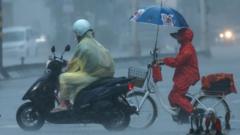
When Typhoon Dolphin slammed into Japan's southern Okinawa prefecture with sustained winds touching 162 kph, it didn't just knock out power lines. It sent a clear message about how fragile modern coastal supply chains remain when nature turns violent.
If you think tropical storms are just seasonal weather blips, look closer. Dolphin packed gusts up to 216 kph, tossing elderly residents to the pavement, cutting power to more than 50,000 buildings across Okinawa and Kagoshima, and forcing Japan Airlines and ANA to ground crucial regional flights. Now, the storm is barreling straight toward China's densely populated eastern seaboard.
The Immediate Damage in Japan
Japan is arguably the most typhoon-prepared nation on Earth, yet Dolphin still exposed vulnerabilities. Five elderly individuals suffered injuries in Okinawa—mostly from literal wind forces knocking them off their feet. Close to 12,000 buildings lost electricity in Okinawa alone, while neighboring Kagoshima saw nearly 39,000 properties plunged into darkness.
Domestic transit vanished overnight. Major airlines wiped entire schedules clean, stranding travelers and halting commercial movement. Why? Because wind speeds of this magnitude turn stray debris into missiles and make aviation an absolute gamble.
China's Scramble Ahead of Landfall
While Japan picks up the pieces, China is bracing for an even harsher impact. Beijing's meteorologists tracked Dolphin right across the East China Sea, positioning its trajectory to hit between Zhoushan in Zhejiang province and Fuding in Fujian.
Authorities aren't taking chances. The National Meteorological Center issued an orange-level typhoon alert, while the marine forecasting body raised a red wave warning. We are talking about monster waves reaching up to eight meters off the coast of Zhejiang.
Look at what happens when a storm of this size approaches a global trade hub:
- Shanghai cleared its massive Yangshan port of all commercial vessels.
- Zhejiang suspended over 160 passenger ferry routes and shuttered local schools.
- Ningbo ordered complete educational shutdowns alongside mandatory docking for hundreds of ships.
- Airlines in regional hubs like Ningbo and Wenzhou prepared widespread cancellations extending through the weekend.
What Most People Misunderstand About Track Projections
Most casual observers look at a weather map and assume a typhoon hits a single point like a pin on a dartboard. That is entirely false.
Eastern China falls directly inside Dolphin's dangerous semicircle. This is the quadrant of the storm where forward motion combines with rotational wind vectors, compounding destructive energy. Forecasters predict cumulative rainfall totals exceeding 600 millimeters in parts of Zhejiang. That volume of water guarantees flash flooding and severe mudslides, transforming hillside communities into disaster zones long after the eye of the storm passes.
What You Should Do Right Now
If you live, travel, or manage assets in the path of eastern China's coastal zones, stop waiting for local sirens.
- Secure outdoor infrastructure immediately. Flying patio furniture or loose signage becomes lethal when 100-mph winds hit.
- Stock up on independent emergency supplies. Power grids in Zhejiang and Fujian will take days to stabilize once high winds subside.
- Cancel non-essential transit. Trying to outrun the storm via domestic flights or coastal rail lines is a losing battle as operators systematically shut down networks.
Nature moves fast, and bureaucracy moves slowly. Respect the red wave warnings and stay indoors.


/cdn.vox-cdn.com/uploads/chorus_asset/file/22155007/doc_ock.jpg)