The next world war won't start on the surface. It’ll happen in the "silent service" territory, thousands of feet below the waves where GPS doesn't work and light never penetrates. While most of us focus on trade wars or Taiwan’s airspace, the People’s Liberation Army Navy (PLAN) is busy charting the jagged canyons and thermal layers of the Western Pacific. They aren't doing this for scientific curiosity. They’re doing it because you can’t win a submarine duel if you’re flying blind.
China is mapping the ocean floor with a level of aggression that should make the Pentagon lose sleep. For decades, the U.S. Navy held a massive acoustic advantage. Our subs were quieter. Our sonar was better. But that gap is closing. By meticulously cataloging the bathymetry—the underwater equivalent of topography—China is creating a "home field advantage" in the deep sea. They’re looking for the hiding spots. They’re looking for the "acoustic highways" where sound travels further, allowing them to spot an American Virginia-class submarine long before it sees them.
The Invisible Battlefield in the Philippine Sea
The geography of the Pacific is a nightmare for submariners. You have deep trenches, underwater mountains called seamounts, and varying salt levels that bend sound waves like a Funhouse mirror. If a submarine commander knows exactly where a cold layer of water sits, they can hide beneath it. The sonar from a surface ship will literally bounce off that layer, leaving the sub invisible.
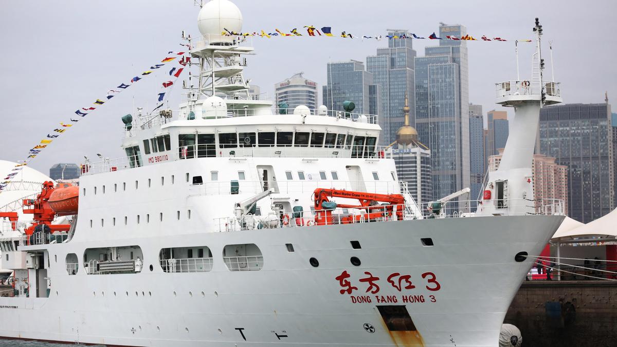
China’s survey ships, like the Zhu Hai Yun—an autonomous mother ship that can launch drones—are constantly crisscrossing the "First Island Chain." They’re dropping sensors. They’re measuring salinity. They’re recording the exact shape of the seabed. This isn't just data. It’s a digital twin of the battlefield. When a Chinese Type 094 ballistic missile sub needs to slip out into the deep Pacific without being tracked by U.S. hydrophones, these maps tell them exactly which trench to use.
It's about survival. A submarine that hits an unmapped seamount is a catastrophic loss. We saw this happen to the USS Connecticut in 2021. It struck an underwater mountain in the South China Sea that wasn't on the charts. That’s an embarrassing and dangerous mistake. China is working day and night to ensure their captains don't have that problem, while hoping the U.S. stays reliant on aging data.
Why Bathymetry is the New Nuclear Arms Race
You might wonder why a map matters so much when we have satellites. Here’s the reality. Satellites can’t see through water. To map the bottom, you need ships on the surface pinging the floor with multibeam sonar. It’s slow. It’s tedious. And China is doing it faster than anyone else.
They’ve deployed a massive network of sensors known as the "Underwater Great Wall." This isn't just a catchy name. It’s a literal grid of acoustic sensors on the sea floor, linked by fiber optic cables. This system does two things. First, it watches for U.S. movement. Second, it constantly gathers environmental data.
The Acoustic Shadow Game
Sound in the ocean behaves weirdly. It’s affected by:
- Temperature (thermoclines)
- Pressure
- Salinity
If you have the better map of these variables, you own the space. Think of it like a sniper. A sniper who knows exactly how the wind blows through a specific canyon has a massive edge over a target just passing through. China is becoming the sniper of the South China Sea. They’re studying the "benthic" environment—the very bottom—to find places where they can park submarines on the floor to wait in silence. That’s a nightmare scenario for U.S. carrier strike groups.
Choke Points and Sea Lines of Communication
Look at a map of the Bashi Channel or the Miyako Strait. These are the narrow gates China must pass through to reach the open ocean. Currently, the U.S. and its allies monitor these gaps with "tripwires." But if the PLAN knows the seafloor better than we do, they can find "blind spots" in our sensor arrays.
They’re also looking at the logistics of undersea cables. Almost all global internet traffic travels through thin wires on the ocean floor. By mapping these routes with precision, China gains the ability to either tap them or cut them in a conflict. It’s a multi-use strategy. The same data that helps a sub navigate also helps a ROV (Remotely Operated Vehicle) find a data cable.
The Dual Use Deception
Beijing often claims these expeditions are for "marine research" or "resource exploration." They talk about deep-sea mining for rare earth minerals. Sure, that’s part of it. But in China, there’s no real line between civilian research and military intelligence. The Great Wall of Sand wasn't built for tourism, and these maps aren't for geologists.
When a Chinese research vessel spends three weeks hovering over a specific patch of the Philippine Sea, they aren't just looking for crabs. They’re looking for the "Deep Sound Channel." This is a layer of water where sound travels for thousands of miles. If you can position your sensors or your subs in this channel, you can hear a ship's engine from across an ocean.
The U.S. used this during the Cold War with the SOSUS system to track Soviet subs. Now, the roles are reversing. China is building their own version, and it's likely more advanced because they're using modern AI to process the "noise" of the ocean. They can filter out whale songs and shipping traffic to find the specific hum of a nuclear reactor.
What Happens When the Maps are Finished
We’re approaching a tipping point. For years, the U.S. assumed its technical superiority would hold. But quantity has a quality of its own. China has more hulls in the water. They’re producing sonar-capable survey ships at a breakneck pace.
If they achieve "undersea transparency," the U.S. loses its greatest deterrent. Our ability to project power depends on the fact that China doesn't know where our subs are. If the ocean floor becomes a well-lit parking lot because of Beijing’s mapping efforts, the tactical math changes instantly.
You can’t just "patch" a map. Once they have the data, they have it forever. The seabed doesn't change much on a human timescale. They’re building a permanent tactical advantage that will last for decades.
How to Track the Shift
If you want to see where the next friction point is, don't look at the surface fleets. Watch the research vessels. Watch where the Haiyang Dizhi ships are going.
Basically, the "Blue Territory" is being claimed through data. The U.S. needs to stop treating oceanography as a secondary science and start treating it as the primary frontier of national security. We need to speed up our own autonomous mapping programs and, frankly, start messing with the data China is trying to collect.
Stop thinking about ships and start thinking about the dirt they’re sailing over. The nation with the best map of the abyss is the nation that will control the surface. Check the latest reports from the Center for Strategic and International Studies (CSIS) or the Naval War College. The data is there. The intent is clear. The race is on, and right now, China is running faster. Look into the "Deep Blue" naval strategy papers coming out of Beijing. That's the real playbook.